×

Holy Cross Website Search

Map and Directions

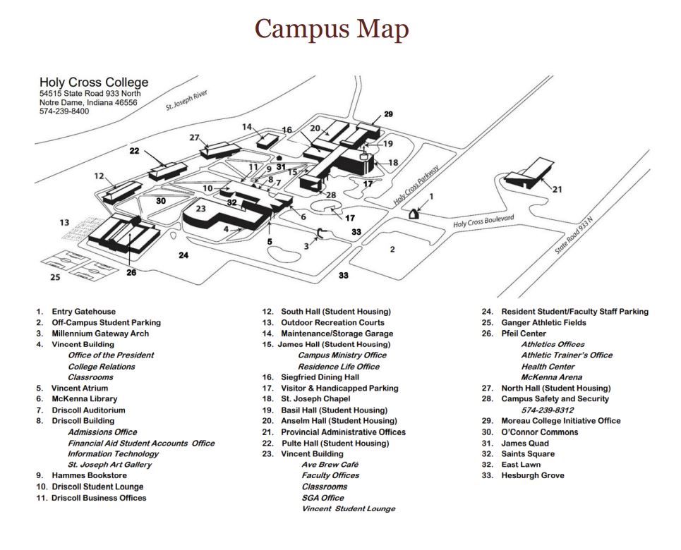
Click here for a printable version of our campus map.
For those who feel called, all roads lead to Holy Cross.
Whether you’re traveling by plane or train, car or bus, what you find when you arrive at Holy Cross College will be well worth the trip. Here’s a little help for your journey. Safe travels.
By car
Holy Cross College is located south of the Indiana Toll Road (Interstate 80/90). If you arrive via the toll road, take Exit 77 and turn right onto Indiana 933. Make a right at the third light (intersection with WNDU/NBC station) and follow the signs for visitor parking.
From the south: take U.S. 31 North, which becomes Indiana 933 just south of South Bend. Stay on Indiana 933, then turn left at the third light north of the St. Joseph River (intersection with WNDU/NBC station) and follow the signs for visitor parking.
By plane
South Bend International Airport (SBN) is five miles from Holy Cross College. Rental cars, taxis, Uber and Lyft can be found at SBN.
You can also fly into Chicago and drive or take the Coach USA bus to Notre Dame’s campus. Holy Cross is roughly 90 miles from downtown Chicago.
By bus
RoyalZoom/Royal Excursion bus line runs regularly from Chicago’s O’Hare (ORD) and Midway (MDW) airports to South Bend International Airport and Notre Dame’s campus. A one-way trip takes approximately three hours.
For visitors from other Midwestern cities, HoosierRide operates several bus lines out of the South Bend airport to Indianapolis, Detroit, Columbus, and Dayton.
By train
The South Shore Line runs directly from Chicago’s Millennium Station to the South Bend International Airport. Amtrak also services South Bend and nearby Niles, Michigan.
Around town
Explore South Bend-area hotel, dining, and attraction information.
If you’re traveling without a car, you can easily get around town via taxi, Uber, or Lyft. Transpo, a public bus system, serves the tri-campus community and our local communities as well.